The tour of this site
Rafting day
Fast boat, both ends
- Length7 hours
- Rating4.8 from 5,022
- Pricefrom $174
Spot your stop
Look at 13 stops
Tap a route first, then a pin or stop, for its note and Google Maps.
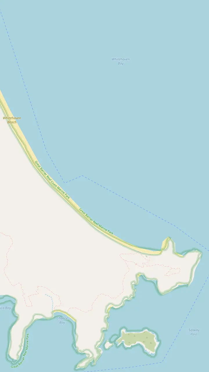
The beach stretches 7 km along the eastern side of Whitsunday Island.
Google MapsThe South-Whitehaven Beach Lookout has views over the beach to Teague Island and Haslewood Island.
Google MapsComposting toilets and picnic tables stand near the national park camping area.
Google Maps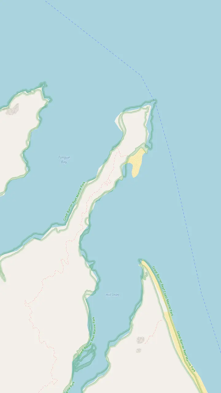
Tours for the lookout land at Tongue Bay on the northern end of Whitsunday Island.
Google MapsOne sailing day visits Whitehaven Beach, Hill Inlet and Betty's Beach.
Google MapsThe walk climbs Tongue Point on a 1.4 km return track to a viewing platform above the inlet.
Google MapsStone steps lead to three lookout platforms with views over turquoise water and white silica sand.
Google MapsHill Inlet lies at the northern end of the beach, where tides mix inlet waters with the surrounding bay.
Google Maps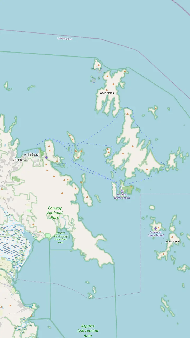
The rafting tour departs from Coral Sea Marina North, with courtesy coach pickups included.
Google MapsThe scheduled boat to Long Island leaves Shute Harbour at 10:30am and 4:50pm daily.
Google MapsPort of Airlie to Daydream Island takes around 30 minutes by ferry.
Google MapsWhitehaven Beach is a 30-minute trip on a high-speed catamaran from Hamilton Island.
Google MapsWhitehaven Beach sits on the eastern side of Whitsunday Island.
Google MapsMap data from © OpenStreetMap contributors
The beach, Hill Inlet, the lookout track and the ports in one place, with the distances and times that decide how a day on the water is laid out.
Editorial team, hillinletlookout.com · Updated November 7, 2026 · Quick read: 7 min
Main facts
Whitehaven Beach lies on the eastern side of Whitsunday Island, which is one of 74 islands set within the heart of the Great Barrier Reef.1,2 The beach stretches 7 km along that shore, and the sand is 98% pure silica that stays cool underfoot.3,4 A Whitehaven Beach map therefore starts with the island and not with the sand: the beach is one long strip on the open side of a national park island, and every useful pin sits around it.
The islands sit off Queensland's central coast, about 1,120 km north of Brisbane and 630 km south of Cairns.10 A Whitehaven Beach Queensland map is best read in layers: the region first, then the beach, then the lookout end. Airlie Beach is the mainland gateway for tours, ferries and sailing.11 Visitors arrive by tour boat, fast vessel, yacht or scenic flight, and no scheduled public ferry runs direct to the sand.8,9
Most of the islands are uninhabited national park, while a handful host resorts.12 Whitehaven Beach is on the park side of that split. It has composting toilets and picnic tables near the national park camping area, and no shops or cafes.13 The beach remains undeveloped within Whitsunday Islands National Park.14 On a map that shows up as pins for tracks, lookouts, landings and a camping area, and never as a town.
Pin by pin
| Pin | Where | What the source says | Use it for |
|---|---|---|---|
| Tongue Bay | North of Whitsunday Island | Tours land here for the lookout21 | The landing |
| Hill Inlet Lookout | Above Hill Inlet | Stone steps to three platforms15 | The swirl view |
| Tongue Point | Track above the inlet | A 1.4 km return walk6 | The walk |
| Whitehaven Beach | East side of the island | Stretches 7 km3 | Sand and swimming |
| South Whitehaven | Southern end | Lookout over Teague and Haslewood islands16 | Long beach time |
| Camping area | Near the south end | Composting toilets and picnic tables13 | The basic stop |
| Coral Sea Marina | Airlie Beach | North side departures | Where the day starts |
| Hamilton Island | Middle of the islands | 30-minute catamaran to the beach22 | An island base |
Positions come from OpenStreetMap; the facts in the third column come from the cited sources, and the rafting price is a from price, not an exact quote.
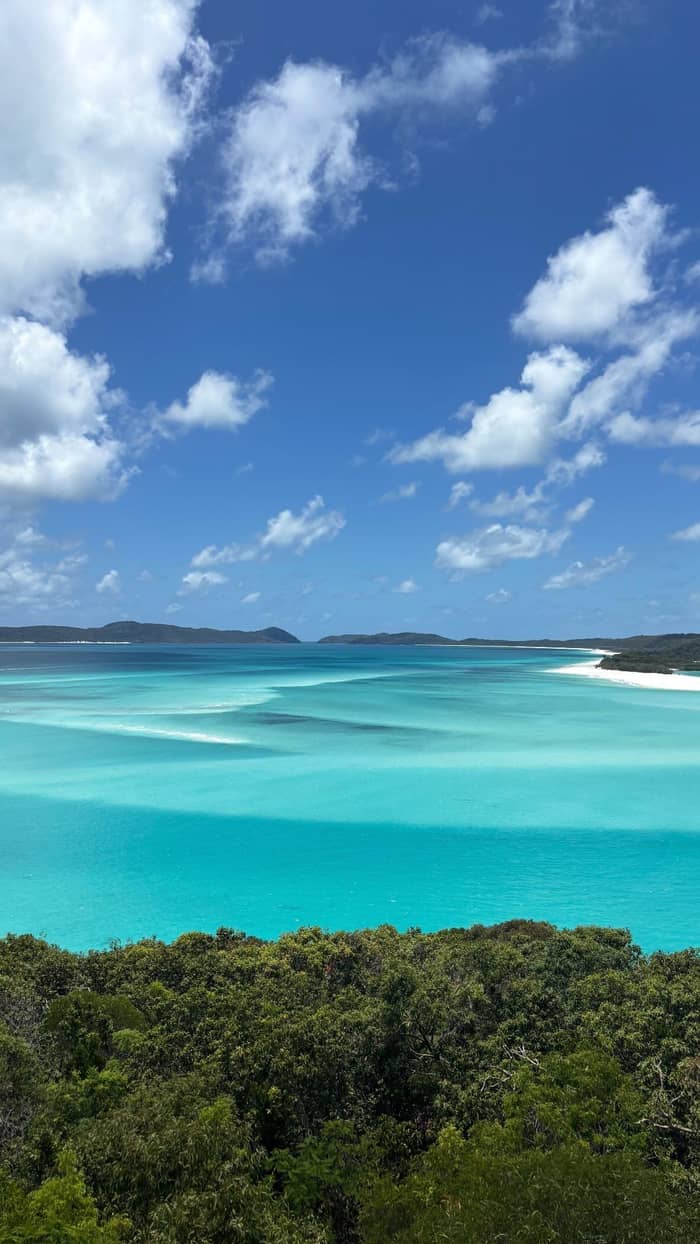
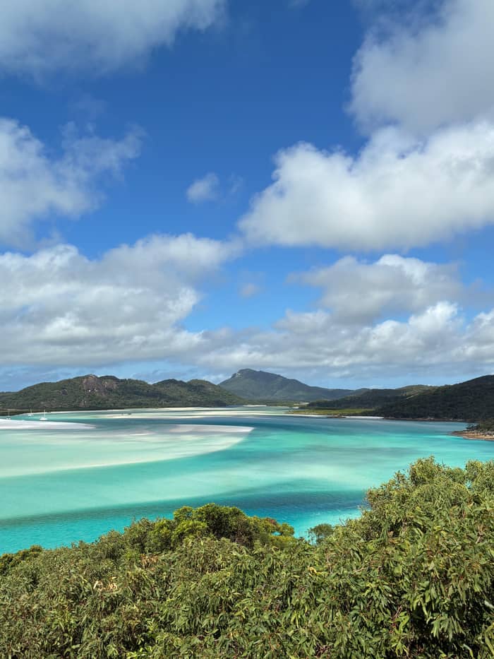
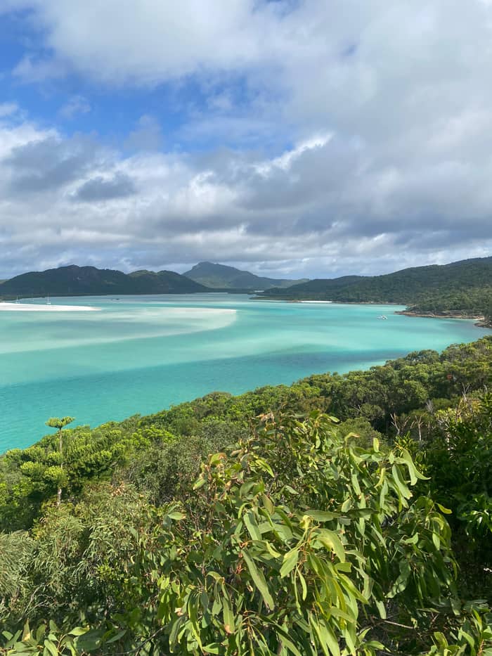
At the northern end of Whitehaven Beach lies Hill Inlet, where tides mix inlet waters with the surrounding bay and draw swirling sand patterns that look best from the lookout above.5 The lookout is a short rainforest climb on Whitsunday Island, with stone steps up to three platforms that look over turquoise water and white silica sand.15 On the pins, the Hill Inlet lookout and the Hill Inlet bay sit close together, yet they are different places: one is a platform on the hill and the other is the water below it.
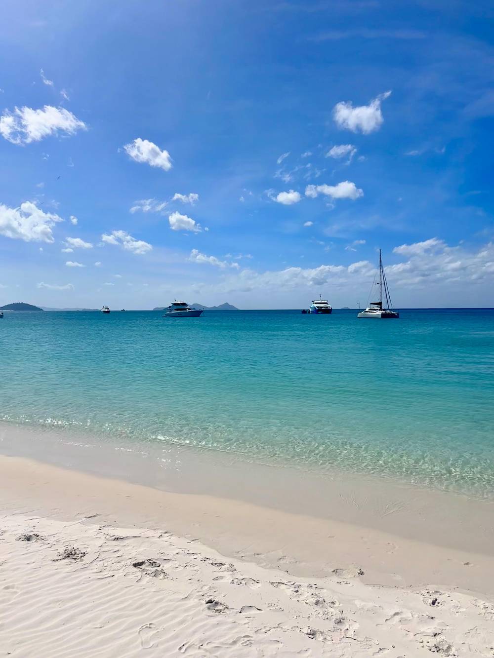
The southern end has a lookout of its own. The South-Whitehaven Beach Lookout is a short headland walk with a well-formed stairway and views over the beach to Teague Island and Haslewood Island.16 The camping area sits close to it on the map, and that is where the beach's basic amenities are found.13 Between the two ends the beach is a long open run of sand, and a map of Whitehaven Beach gives the middle a single pin.
The rafting day booked through this site uses the geography in two ways. Its Southern Lights option is described as visiting both ends of the beach, with about two hours at the southern end, followed by a guided walk through the bush up to the lookout above Hill Inlet. The Northern Exposure option spends an hour on the beach at North Whitehaven and then joins the bushwalk to the lookout. It is the same beach with a different end first, and a look at the pins makes the difference plain.
Times on the way
The lookout walk is around 40 minutes, the Long Island boat takes about 30, the airport is about 40 from Airlie Beach, the Hamilton ferry is 60 and Airlie Beach is 20 by road off the Bruce Highway.7,17,18,19,20
Tours that include the lookout land at Tongue Bay on the northern end of Whitsunday Island.21 From the beach, the walk climbs Tongue Point on a 1.4 km return track to a viewing platform above the inlet.6 Tourism Whitsundays' beach page puts the walk at around 40 minutes on established walking tracks.7 On the Hill Inlet panel of the map, Tongue Bay, Betty's Beach, Tongue Point and the lookout form one tight cluster, and the whole walk happens inside it.
The climb is short but real. Tourism Whitsundays notes that the walk includes a short uphill climb on a formed track.25 Betty's Beach is the neighbour on the map, and a sailing day listed by the same body visits Whitehaven Beach, Hill Inlet and Betty's Beach.26 Anyone planning a family visit can read the track as a small hill rather than a hike, though the steps and the heat make an unhurried pace sensible.
Shoes matter more than the distance suggests. Walks longer than 30 minutes call for sturdy footwear, plenty of water, sun protection and insect repellent, and most national park islands have no drinking water.27,28 The lookout return takes around 40 minutes, so it sits right on that line.7 Treat the Tongue Point pin as a proper walk and carry water from the boat.
Pick your pin
Choose the line that matches your day and the answer sits beside it.
If I want the swirling-sand view
Land at Tongue Bay
Tours for the lookout land at Tongue Bay, and the walk climbs Tongue Point.21,6
If I want long time on the beach
Choose a day with South Whitehaven
The Southern Lights option lists approximately two hours at South Whitehaven.
If I want both ends of the strip
Pick a day with lookout and beach
Tours with both the lookout and North or South Whitehaven give the fullest experience.23
If I want the view from above
Look at scenic flights
Scenic flights by seaplane, helicopter or light aircraft show the beach and Hill Inlet from above.24
If I am staying on Hamilton Island
Use the island departure
Whitehaven Beach is a 30-minute catamaran trip from Hamilton Island.22
Three boats, one map
The tour of this site
Fast boat, both ends
Cruise option
Hill Inlet and the beach
Cruise option
Beach, lookout, Hook Island
Airlie Beach is the main mainland gateway, and from its marinas day tours depart daily to the islands, the reef and Whitehaven Beach.11,35 The rafting listing says its tours depart from Coral Sea Marina North, with courtesy coach pickups included. Most operators offer pick-up from Airlie Beach accommodation, so the marina pin on the map is only the start of the day for those who walk to it.31
Other starting points appear on the regional panel too. Whitehaven Beach is reached from Hamilton Island and Daydream Island as well, and Hamilton Island advertises a 30-minute trip on a high-speed catamaran.8,22 The Hamilton Island ferry crossing from Airlie Beach is a 60-minute trip, and Daydream Island is 30 minutes from Airlie Beach by ferry.19,36 Place the three on a map and the pattern is clear: the beach is the far point and the islands are the stepping stones.
Two airports serve the region. Whitsunday Coast Airport near Proserpine suits Airlie Beach and mainland stays, while Great Barrier Reef Airport on Hamilton Island suits island stays and connects to the mainland by ferry.37 The Proserpine airport is approximately 40 minutes from Airlie Beach.18 Shute Harbour, the second pin on the regional panel, is where the scheduled boat to Long Island leaves at 10:30am and 4:50pm daily, which makes it a handy landmark on the water.17
The boat day
Check-in
Tours depart from Coral Sea Marina North, with courtesy coach pickups included.
The ride out
The listing calls the semi rigid inflatable vessels super fast, and the ride runs out to the Whitsunday Islands.
North end
The Northern Exposure option spends an hour on the beach at North Whitehaven and joins a guided bushwalk to the lookout.
South end
The Southern Lights option spends approximately two hours at South Whitehaven, then takes a guided bush walk to the lookout.
Reef stop
The itinerary names snorkel sites at Hook Island and Border Island, with a buffet style lunch served at the beach.
Whole day
The listing gives a duration of 7 hours for the whole day.
Tourism Whitsundays says that tours which include both the lookout and time on North or South Whitehaven give the fullest experience.23 That is the map advice in one line. A day that touches the lookout end and a beach end covers the whole strip, while a tour that stops only at the lookout covers the pins on the Hill Inlet panel and nothing else.
The rafting day is listed at 7 hours for groups of up to 32, from $174, with free cancellation up to 24 hours in advance. It runs on semi rigid inflatable vessels that the listing calls super fast, and its itinerary names snorkel sites at Hook Island and Border Island. Prices on this site are from prices, so treat $174 as a starting figure and read the live listing for the exact fare on your date.
Other listings reach the same ends in other ways. A Hill Inlet lookout and Whitehaven cruise is listed at 8 hours from $167, and an eco-cruise that adds Hook Island is listed at 8 hours from $175. The map does not change between them. Only the boat, the length of the day and the time you spend at each pin do.
Video
World Wild Hearts on YouTube · The clip loads only after you tap play.
Hill Inlet is located at the northern end of Whitehaven Beach, where tides mix inlet waters with the surrounding bay, creating swirling sand patterns best viewed from the lookout above.
Before you go
The sand patterns at Hill Inlet change with tidal movement and weather, so each visit shows different formations and colours.38 A map can place the lookout but it cannot say what the water will be doing when you arrive. At mid to low tide, more of the pale silica sand shows through the shallows, and most operators plan their visit around the tide.39,30
A map cannot show the rules either. CASA rules apply to drones, and the park prohibits them in protected-area camping areas.40 Other park use may need authority, including commercial filming or drones over 2 kg.41 On the Hamilton Island side, recreational and sport drone use is not permitted on the island or in the surrounding waters.42 Check the current restrictions before you take anything into the air.
Seen from above, the same map looks different. A popular way to see Whitehaven Beach, Hill Inlet and the surrounding islands from above is a scenic flight by seaplane, helicopter or light aircraft, and some flights include a beach landing.24,43 That view belongs to the flight, which is a separate trip from the boat day described here, and the pins on this page are all ones you can reach on foot once you are ashore.
FAQ
The listing says tours depart from Coral Sea Marina North, with courtesy coach pickups included.
The beach has composting toilets and picnic tables near the national park camping area, and there are no shops or cafes on site.13
Sources
Questions about the Hill Inlet day? A real person answers here.