Clickable chart
Hill Inlet lookout swirling sands: what the tide does
Twelve months at the inlet
The inlet through the year
Choose a month to compare sunset, day length and the usual warmth near Hill Inlet, with what the sources say about it.
Sunset
Jan
January and February each average more than 3 days of rain at 25 mm or more.26
Feb
February is the wettest month at the nearest station, with 352 mm of rain.24
Jun
Winter, June to August, is the peak season of dry, clear days.17
Aug
Winter stays dry and mild, in the peak season.17
Sep
September has the most settled skies and the lightest winds of the year at Hamilton Island.25
Sunset is worked out for the 15th of each month on Queensland time. Day length and temperatures: NOAA averages for the Hamilton Island Airport station, 15.9 km from the inlet, 1991 to 2020.
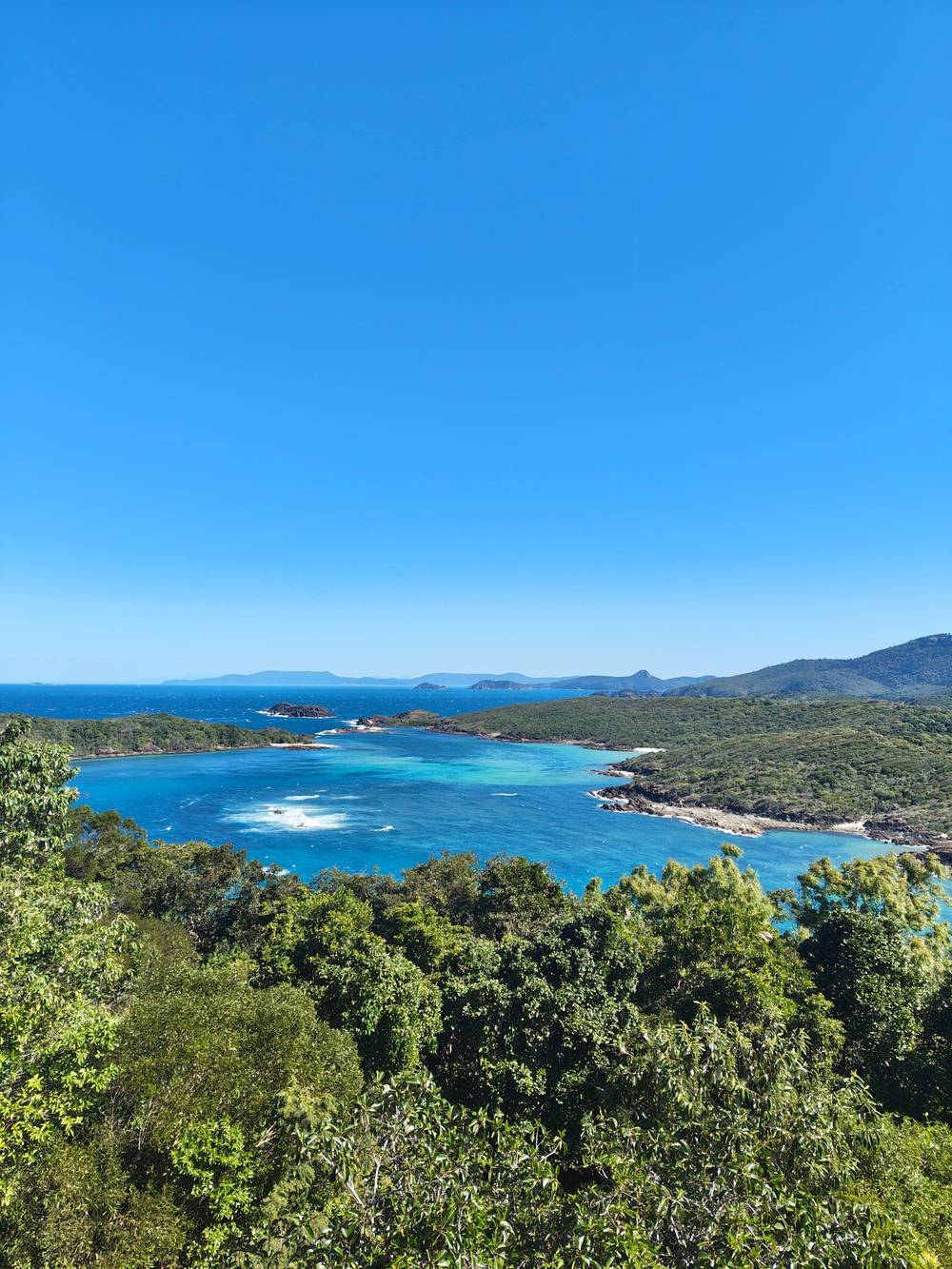
The sand patterns below the Hill Inlet lookout change with every tide. Here is how the water and the light shape them, and what low water does to a boat day.
Editorial team, hillinletlookout.com · Updated November 7, 2026 · Quick read: 7 min
Main facts
- What it isTides mix inlet water with the bay at the north end of Whitehaven Beach, drawing swirls of sand.1
- Which tideMid to low tide shows more of the white silica sand through the water.2
- Which lightEarly morning light gives the clearest water and the best colour separation.3
- The catchLow tide can stop some boats reaching Tongue Bay, the entry point to Hill Inlet.4
- No two alikeThe patterns change with every tide, so no two visits look the same.5
What the swirl is, and why it keeps changing
Hill Inlet sits at the northern end of Whitehaven Beach, where tides mix the inlet waters with the surrounding bay and create swirling sand patterns that are best seen from the lookout above.1 The sand itself is the star: Tourism Whitsundays says Whitehaven Beach is made up of 98% pure silica sand, a pale grain that stays cool underfoot.6 Cruise Whitsundays describes the silica as washed in on the tide over thousands of years.7
The pattern is never fixed. Tourism Whitsundays writes that the sand patterns change with tidal movement and weather, so each visit shows different formations, from white ribbons through turquoise shallows to deeper blue channels.8 A second Tourism Whitsundays page says the patterns change with every tide and that no two visits look the same.5 The operator Ocean Rafting makes the same point with a saying: no two photos of Hill Inlet are ever the same.9
That is worth knowing before you plan a photograph of the Hill Inlet swirl sand. You cannot book the swirl as a fixed sight, the way you book a ticket to a building. You book a day, an operator and a tide, and the inlet shows whatever the water is doing. The rest of this page gives you what the official and operator sources say about steering that luck in your favor.
Tide and light at a glance
What each moment does to the view
| Moment | What it does | Source |
|---|---|---|
| Mid to low tide | Reveals more white silica sand through the water2 | Tourism board |
| Low tide | Can stop a catamaran reaching Tongue Bay4 | Cruise operator |
| Any tide | Patterns change, so no two visits look the same5 | Tourism board |
| Early morning | Clearest water and best colour separation3 | Tourism board |
| Afternoon | The patterns still show on an afternoon visit15 | Tourism board |
These are statements by the named sources, not tide readings of our own.2,4
Which tide shows the most sand
The advice from Tourism Whitsundays is specific: mid to low tide reveals more of the white silica sand through the water.2 The same page adds that early morning brings cooler walking conditions and fewer people at the lookout.2 The same page adds that most tour operators time their visit around the tide for the best view.13
That does not mean a high tide wastes the trip. Ocean Rafting argues that the lookout is worth the walk at any tide, and describes the view as one that is guaranteed to take your breath away, regardless of the tide.14 It is an operator speaking about its own product, so read it as encouragement rather than measurement. The patterns exist at every state of the water; they are simply less sharp when the banks are covered.
A morning can also carry more than one tide. Tourism Whitsundays says afternoon visits still showcase the distinct patterns that have made this one of the most photographed spots in the Whitsundays, so a boat that reaches the lookout after lunch still delivers the view.15 The choice between a morning and an afternoon boat is then about light and crowds as much as about water height.
Rain and heat through the year
Month by month at the nearest station
- Jan10.8 h
- Feb11.2 h
- Mar11.8 h
- Apr12.4 h
- May12.8 h
- Jun13.1 h
- Jul13.0 h
- Aug12.6 h
- Sep12.0 h
- Oct11.5 h
- Nov10.9 h
- Dec10.7 h
The chart plots hours with no sun (mid-month) and days that get at least 2.5 mm of precipitation. Data: NOAA, station Hamilton Island Airport, 1991 to 2020.24
Reading the tide at Shute Harbour
The Reef Authority itself refers to the tide at Shute Harbour when it describes the Tongue Bay landing, so the Shute Harbour predictions are the ones to read.16 Maritime Safety Queensland's 2026 tide tables give Shute Harbour mean high water springs of 3.35 m, mean low water springs of 0.58 m and a highest astronomical tide of 4.39 m, all above the Queensland port datum.11
The ordinary day is a little gentler. The same tables give mean high water neaps of 2.62 m and mean low water neaps of 1.31 m.12 Tides at Whitehaven Beach are read from that port, and as an example of how much water moves in a day, the table for 1 January 2026 lists a low of 0.35 m at 0212, a high of 4.03 m at 0905, a low of 0.88 m at 1531 and a high of 2.78 m at 2106.10 The height at the dock is not the height at the lookout, so treat these as a guide to the rhythm of the water and not to the exact view.
You will not need to do the sums yourself on a tour day. The operators make the call, and they time visits around the tide.13 What the table gives you is a reason to ask the right questions: on the day you want, is low water in the middle of the day, or early or late? An operator that can answer that is planning around the tide, which is exactly what you want.
A short chooser
Plan around the water
Pick what matters most and see what the sources suggest.
If I want the sharpest swirl
Aim for mid to low tide
Mid to low tide reveals more of the white silica sand.2
If I want the clearest colours
Choose an early boat
Early morning brings the clearest water and best colour separation.3
If I can only go in the afternoon
Go, and expect patterns
Afternoon visits still show the distinct patterns.15
If I sail on a big catamaran
Ask about low-tide access
Low tide can prevent a catamaran accessing Tongue Bay.4
If My dates are fixed
Book free cancellation
Our listing allows free cancellation up to 24 hours before.
When low tide changes the plan
Low water brings the one real risk to the day, and the lookout walk starts from the same beach as the landing. The Reef Authority's site plan says the tender channel at Tongue Bay is marked with reflective tape that shows 0.5 m of water over the reef when the tide at Shute Harbour is 0.7 m, and that tenders should take care on a lower tide.16,21
Cruise Whitsundays spells out the effect for its sailing catamaran: tidal restrictions at low tide can prevent the boat accessing Tongue Bay, the entry point to Hill Inlet and the northern end of Whitehaven Beach.4 The skipper then selects another location, typically the southern end of Whitehaven Beach, and the guests still enjoy the white sand and clear water even though the lookout may not be accessible.20 The same operator marks the guided walk to the lookout as tidal dependent.22
Ocean Rafting states that its tour itinerary is a guideline only and can change with tide, wind and other weather conditions.23 The Viator listing for its day sets out the lookout walk and the time on Whitehaven Beach, and does not promise a given tide. Free cancellation up to 24 hours before gives you room to move the day if the tide tables look unkind.
Work out the bill
Days that reach the inlet
Pick the party size and see the from price of each day that reaches Hill Inlet.
Look at 4 options
Days that reach the inlet
Pick the party size and see the from price of each day that reaches Hill Inlet.
- Our boat day7 hours · for each guest from $174
≈
View - Catamaran with buffet8 hours · for each guest from $175
≈
View - Camira sailing day10 hours · for each guest from $182
≈
View - Hill Inlet cruise8 hours · for each guest from $167
≈
View
Currency conversion uses the ECB reference rate on GetYourGuide from-prices. The exact price is displayed when you book.
One tide day at Shute Harbour
How the water moves in a day at Shute Harbour
0212
First low water
The table lists a low of 0.35 m at 0212 on 1 January 2026.10
0905
High water
The first high of that day was 4.03 m at 0905.10
1531
Second low water
The afternoon low was 0.88 m at 1531.10
2106
Evening high
The evening high was 2.78 m at 2106.10
Spring range
Where the extremes sit
Mean high water springs are 3.35 m and mean low water springs 0.58 m.11
Neap range
Where it is gentler
Mean high water neaps are 2.62 m and mean low water neaps 1.31 m.12
Light, season and the colour of the water
Light changes the picture as much as the tide. Tourism Whitsundays says early morning light gives the clearest water and the best colour separation, and calls that a good reason to book a morning departure.3 Its beach page adds that early morning can offer softer light and cooler walking conditions.15 Sun, cloud and wind all alter how the water reads from above, so a perfect photograph needs luck as well as a plan.
The season matters mostly for comfort. Tourism Whitsundays calls Whitehaven a year-round beach, with winter from June to August as the peak season of dry, clear days and mild temperatures, and summer as warmer, wetter and quieter.17 The Hamilton Island Airport station, 15.9 km from the inlet, averages 278 mm of rain in January and 352 mm in February, against 31 mm in September.24,24,24 Tourism Whitsundays also says September has the most settled skies and the lightest average winds of the year at Hamilton Island.25
None of this decides the view, which belongs to the tide, but it shapes the day around it. In the wet months, rain shows up as afternoon build-up, and the same page notes that January and February each average more than 3 days of rain at 25 mm or more.26 A dry-season morning with a mid to low tide is the combination the sources point to. Anything else is a trade you make with your calendar.
Video
The Hill Inlet walk during low tide
K&I Travels on YouTube · The clip loads only after you tap play.
The patterns change with every tide, so no two visits look the same.
Before you go
A checklist for the swirl
Plan the tide3
Plan the light3
What to do on a day the tide is not on your side
First, keep expectations in proportion. Operators time their visits around the tide and one says the view is worth seeing at any tide, so a mediocre tide may mean a softer picture and not an empty one.13,14 Wear shoes you can walk in, as Ocean Rafting recommends for the Hill Inlet tours and the walk to the lookout.18
Second, know what your version of the day offers. Ocean Rafting describes a Northern Exposure day with 1 to 1.5 hours at Hill Inlet, and a Southern Lights day with about two hours at the southern end of Whitehaven Beach.27,28 If the water is wrong for Tongue Bay, a day built around the southern end still delivers a long beach stop, and the lookout view remains a short walk away when the landing is possible.20
Third, use the sand itself. Tourism Whitsundays calls Whitehaven a beach with soft sand that stays cool underfoot and clear, calm water that invites you to walk, swim or slow down.6 That is a fair description of a day when the swirl is subtle: you still get the long white beach, the water and the boat ride, and the picture from above is a bonus on top.
FAQ
Quick answers to quick questions.
What causes the swirling sands at Hill Inlet?
Tourism Whitsundays says tides mix inlet waters with the surrounding bay and create swirling sand patterns best viewed from the lookout.1
What is the best tide to see Hill Inlet?
Tourism Whitsundays says mid to low tide reveals more of the white silica sand through the water.2
Is Hill Inlet worth seeing at high tide?
Ocean Rafting says the lookout view is guaranteed to impress regardless of the tide, though that is its own claim.14
Does the time of day matter at Hill Inlet?
Early morning light gives the clearest water and the best colour separation, says Tourism Whitsundays.3
Can low tide stop a boat reaching Hill Inlet?
Where do I read the tide times?
How big is the tide at Shute Harbour?
Those are the mean high and low water springs for 2026, with a highest astronomical tide of 4.39 m.11
Do the patterns look the same every visit?
Tourism Whitsundays says the patterns change with every tide, so no two visits look the same.5
Sources
- Tourism Whitsundays (regional tourism organisation) · Whitehaven Beach & Hill Inlet ↩
- Tourism Whitsundays (regional tourism organisation) · Whitehaven Beach & Hill Inlet ↩
- Tourism Whitsundays (regional tourism organisation) · Whitehaven Beach: A Complete Visitor Guide ↩
- Cruise Whitsundays (operator official site) · Camira Sailing Adventure ↩
- Tourism Whitsundays (regional tourism organisation) · Whitehaven Beach: A Complete Visitor Guide ↩
- Tourism Whitsundays (regional tourism organisation) · Whitehaven Beach & Hill Inlet ↩
- Cruise Whitsundays (operator official site) · Whitehaven Beach & Hill Inlet Tours & Experiences ↩
- Tourism Whitsundays (regional tourism organisation) · Whitehaven Beach & Hill Inlet ↩
- Ocean Rafting (operator official site) · Ebs and Flows ↩
- Maritime Safety Queensland (Queensland Tide Tables 2026) · Queensland Tide Tables 2026, Shute Harbour ↩
- Maritime Safety Queensland (Queensland Tide Tables 2026) · Queensland Tide Tables 2026, Semidiurnal Tidal Planes ↩
- Maritime Safety Queensland (Queensland Tide Tables 2026) · Queensland Tide Tables 2026, Semidiurnal Tidal Planes ↩
- Tourism Whitsundays (regional tourism organisation) · Whitehaven Beach & Hill Inlet ↩
- Ocean Rafting (operator official site) · Ebs and Flows ↩
- Tourism Whitsundays (regional tourism organisation) · Whitehaven Beach & Hill Inlet ↩
- Great Barrier Reef Marine Park Authority (gbrmpa.gov.au) · Townsville/Whitsundays site specific management ↩
- Tourism Whitsundays (regional tourism organisation) · Whitehaven Beach: A Complete Visitor Guide ↩
- Ocean Rafting (operator official site) · FAQ ↩
- Tourism Whitsundays (regional tourism organisation) · Whitehaven Beach & Hill Inlet ↩
- Cruise Whitsundays (operator official site) · Camira Sailing Adventure ↩
- Great Barrier Reef Marine Park Authority (gbrmpa.gov.au) · Townsville/Whitsundays site specific management ↩
- Cruise Whitsundays (operator official site) · Camira Sailing Adventure ↩
- Ocean Rafting (operator official site) · FAQ ↩
- NOAA · Global Summary of the Month, Station Hamilton Island Airport (NOAA GHCN ASN00033255), 1991 to 2020 ↩
- Tourism Whitsundays (regional tourism organisation) · Best Time to Visit The Whitsundays ↩
- Tourism Whitsundays (regional tourism organisation) · Best Time to Visit The Whitsundays ↩
- Ocean Rafting (operator official site) · FAQ ↩
- Ocean Rafting (operator official site) · FAQ ↩